Archive by Author

Discovery Map Series: 1846 New Map Of Maine

06 Feb
Antique_Maine_Map_Historic_Hand_Painted_1000_dpi_JPG_H-145-1KDPI-ECOM-GRAT_1

This map is significant in that it appeared in 28 different versions between the years 1833 and 1860. Originally, Henry Tanner, a prominent map publisher from Philadelphia, created the map for inclusion in his Universal Atlas. Eventually, several other Philadelphia map publishers issued the same atlas following the year 1842. In 1846, Samuel Augustus Mitchell […]

Weekly Map Giveaway Winner!

05 Feb

Sign up for our weekly map give-away here! This week’s mystery winner is… belindsay@ If your email address starts with “belindsay” please email me at: [email protected] to claim your free map! The entire email address has been omitted for your privacy. The name on this page is changed weekly, and chosen with random.org. Thank you […]

Weekly Map Giveaway Winner!

29 Jan

Sign up for our weekly map give-away here! This week’s mystery winner is… elizabeth.m.wiles@ If your email address starts with “elizabeth.m.wiles” please email me at: [email protected] to claim your free map! The entire email address has been omitted for your privacy. The name on this page is changed weekly, and chosen with random.org. Thank you […]

Discovery Map Series: Minocqua Chain of Lakes

09 Jan
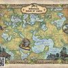
minocquachainoflakeswatermarked

There’s more to a lake than it simply being a body of water. Many lakes have helped to shape the vibrant history and culture of certain regions. Lakes provides environmental benefits, influence quality of life, strengthen economies through tourism, provide amazing opportunities for recreation and cottage/residential living, and serve as a source of drinking water […]

Travel Tuesday Map Feature: 287-Ornate Flathead Lake, Montana Designed and Painted by Lisa Middleton

21 Dec
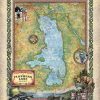
Flathead_Lake_36x45_3

Flathead Lake, with a surface area of up to 197 square miles, is the largest natural freshwater lake west of the Mississippi River in the continental United States. The lake is roughly 27 miles long and 15.5 miles wide at its widest point. It has an average depth of 165 feet, but a maximum depth […]

Discovery Map Series: 069 Les Etats Unis 1781

12 Dec
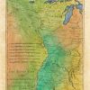
Les_Etats_Unis

This map is expertly drawn and features the region that stretches from the Mississippi Valley upwards towards the Appalachian Mountains. This map was drawn right around the time of the American Revolution by French mapmaker Rigoberto Bonne. Bonne was a noted cartographer of his day in that his works begin to detour from the traditional […]

Discovery Map Series: 064 La Florida 1570

05 Dec
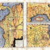
La_Florida

La Florida Gvastecan Pervviae Avriferae Regionis Typvs Born in Antwerp Belgium in 1527, Abraham Ortelius was one of the most non-assuming influential cartographers the craft has ever seen. He was so non-assuming that his tombstone in Antwerp reads…Quietis Cultor sine bit, uxore, prole, which means, served quietly, without accusation, wife, and offspring. While he was […]