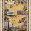
This is a digitally colored map designed by Lisa Middleton and her creative and cartographic team. All sizes are approximate Order Your Own Copy Here You will also love our antiquarian map collection! Click Here

This is a digitally colored map designed by Lisa Middleton and her creative and cartographic team. All sizes are approximate Order Your Own Copy Here You will also love our antiquarian map collection! Click Here

‘Tis the season for Pumpkin Spice EVERYTHING! And our annual one-for-you-and-one-for-them sale! Doesn’t sepia make you think of Pumpkin Spice? ‘Tis the season for Pumpkin Spice EVERYTHING! This is one pumpkin spice that will not add any unwanted pounds and will last for years on your wall. All of November and December we offer one […]
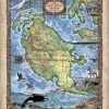
Forget about a tropical retreat for a moment and think of a panoramic valley, dotted with cows, vineyards, iconic lighthouses, whale watching in the distance, and lush forest. San Juan Island is one of four islands, and the second-largest of the San Juan Archipelago, located in the northwest region of the contiguous United States between the […]
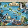
Hawaii Waterfalls, Beaches, and Natural Lands Out in the middle of the Pacific Ocean lies Hawaii, home to one of the world’s most active volcanoes and the tallest sea mountain in the world. This chain of islands is roughly 2000 miles (3200 kilometers) from the coast of the Continental United States. Hawaii is made up of […]
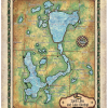
There’s more to a lake than it simply being a body of water. Many lakes have helped to shape the vibrant history and culture of certain regions. Lakes provides environmental benefits, influence quality of life, strengthen economies through tourism, provide amazing opportunities for recreation and cottage/residential living, and serve as a source of drinking […]
As the largest man-made lake in the Midwestern United States, Lake of the Ozarks extends across the Missouri counties of Benton, Camden, Morgan and Miller. It has a surface area of 54,000 acres and 1,150 miles of shoreline, with the main channel of the Osage Arm stretching for 92 miles and a total drainage area over […]
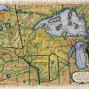
Plan of Captain Carvers Travels 1781 Detailing the travel routes that Capt. Jonathan Carver made to the interior parts of North America, this 1781 map by the same name is quite detailed. Colorization is used to detail the boundaries of theof the area. These include mostly Native Americans as well as a few other types […]
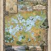
Nestled within western Hennepin County and Carver County, Minnesota, Lake Minnetonka holds unique meaning for different people. The retreating Wisconsin Glacier of the last Ice Age that produced melted blocks of ice, gave life and form to this island lake. It was Alexander Ramsey, Minnesota’s territorial governor in 1852, who gave Lake Minnetonka its name. […]
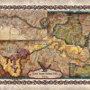
The Grand Canyon became a National Park in 1919 and is undoubtedly one of the world’s natural wonders. Situated in Arizona, the park is 277 miles long, roughly 18 miles wide and has a depth of more than a mile. The Grand Canyon is carved by the Colorado River and features layered bands of red […]
Follow Us!