Archive by Author

Travel Map Feature: The Bahama Out Islands

04 Feb
1

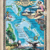
Rich in history, culture, heritage, and tranquil natural beauty, the Out Islands of the Bahamas calls to the connoisseurs of Caribbean island life, and those individuals who desire to retreat to a place that seemingly slows in time and offers up naturally wondrous  untainted pieces of paradise. The Out Islands of the Bahamas makes up […]

Feature articles for our Retailers

14 Jan

Well-Organized Retail Displays! Suggestions using Grid Wall, Pro Panels, Bins and More. Framing print samples for Maximum Sales Ideas for our favorite frames. Customers love ready-made art! Mastering the Art of Lighting for Maximum Print Sales! Lighting is an inexpensive way to add value to your map display. The importance of placement and rotation of […]

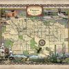
Travel Map Feature: 222 Custom map of Tucson, Arizona

07 Jan
Tucsan

Nicknamed the Optics Valley, Tucson is situated on an alluvial plain in the Sonoran Desert, surrounded by the Santa Catalina Mountains, Tortolita Mountains, Santa Rita Mountains, Rincon Mountains, and the Tucson Mountains. The first humans are believed to have lived in Tucson about 10,000 BCE, with the migrations of Paleo-Indians and Archaic hunters and gatherers. […]

Weekly Map Giveaway Winner!

14 Dec

Sign up for our weekly map give-away here! This week’s mystery winner is… johnhbivins@ If your email address starts with “johnhbivins″ please email me at: [email protected] to claim your free map! The entire email address has been omitted for your privacy. The name on this page is changed weekly, and chosen with “randomnamepicker.org” Thank you […]

Quick Menu for Last Minute Christmas Map Art Shopping

01 Dec

….  Can’t See the whole Menu?  Please click Post title above posting to expand it!    …………………………             CLICK HERE TO SEARCH our shopping site by any KEYWORD… Search state, date, cartographer, locale, etc. If you don’t find it, Call us! 888-255-7726 Hand painted originals available now! Usual wait period is 1 […]

Educational Map Series: Portolan Chart Of The Mediterranean And Black Seas With The West Coast Of Spain And Portugal

20 Oct
black seas

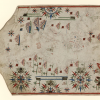
In early times, the Mediterranean Sea was the central point of transport, trade and cultural connection between North Africa, Western Asia and Southern Europe. The Italians, the Genoese and the Venetians, in particular, made their mark on the Mediterranean shores as traders. Sailing by way of the Mediterranean and Black Seas was essential to commerce […]

Educational Map Series: Portolan Chart Of The Mediterranean And Connecting Seas

13 Oct
map b

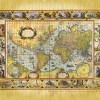
The nautical chart titled A Portolan Chart of the Atlantic Ocean and Adjacent Continents was published in 1633 and is attributed to Dutch cartographer Pascal Roiz. Roiz worked as a cartographer during the second half of the 17th and early 18th centuries. In the 1640s, he worked under the guidance of Willem Blaeu in Amsterdam, […]

Educational Map Series: Portalan Chart Of The Mediterranean And Connecting Seas

06 Oct
map A

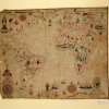
Housed in the Library of Congress is the Portolan Chart of the Mediterranean and Connecting Seas. This 1550 portolan chart’s cartographer is unknown, and its title is one devised by a cataloguer. Still, its significance is not to be overlooked as it represents a significant example of an early marine invention that greatly enhanced sea […]