There’s more to a lake than it simply being a body of water. Many lakes have helped to shape the vibrant history and culture of certain regions. Lakes provides environmental benefits, influence quality of life, strengthen economies through tourism, provide amazing opportunities for recreation and cottage/residential living, and serve as a source of drinking water […]
Archive | Map Art News
RSS feed for this sectionEnjoy our archive of Lisa’s monthly newsletters
Weekly Map Giveaway Winner!
Sign up for our weekly map give-away here! This week’s mystery winner is… m.wendland@ If your email address starts with “m.wendland” please email me at: [email protected] to claim your free map! The entire email address has been omitted for your privacy. The name on this page is changed weekly, and chosen with random.org. Thank you […]
Weekly Map Giveaway Winner!
Sign up for our weekly map give-away here! This week’s mystery winner is… sherimalcom@ If your email address starts with “sherimalcom” please email me at: [email protected] to claim your free map! The entire email address has been omitted for your privacy. The name on this page is changed weekly, and chosen with random.org. Thank you […]
Discovery Map Series: Okinawa, Japan

Okinawa, Japan From the 15th to the 19th century, Okinawa flourished as the Kingdom of Ryukyu, an autonomous state that operated outside the bounds of Japan’s central government. In 1879, the Kingdom of Ryukyu was integrated into Japanese society and the name of the islands was changed to Okinawa prefecture. Okinawa comprises of 160 islands […]
Travel Map Feature: Lakes Of Vilas County Wisconsin

Vilas County has the most lakes of all the counties in Wisconsin, with 563 named and 755 unnamed lakes that covers roughly 93,889 acres. It is also home to one of the largest collections of freshwater lakes in the world. Lac Vieux Desert Lake in Phelps is the largest of the Vilas County lakes. These […]
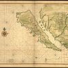
Discovery Map Series: Map of California Shown As An Island, 1650

A 1650 map, created by Joan Vinckeboon, titled “Map of California Shown as an Island,” echoes the inaccurate belief of cartographers, whose early maps depicted California as an island, separate from mainland North America. The Dutch cartographer and engraver Vinckeboon was born into a Flemish family of artists and started out drawing for his father. About 1640, […]
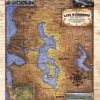
Tuesday Travel Feature: Custom Map Of Lake Washington And Vicinity

This is a map depicting Lake Washington, located in Cook County. The insets depict various things that have happened close to Lake Washington over the past century. The battle of Seattle was waged by the Native Americans in 1856. And a surprise ambush, they engage the early settlers of the Washington territory for four days. […]
Weekly Map Giveaway Winner!
Sign up for our weekly map give-away here! This week’s mystery winner is… mtbumgardner@ If your email address starts with “mtbumgardner” please email me at: [email protected] to claim your free map! The entire email address has been omitted for your privacy. The name on this page is changed weekly, and chosen with random.org. Thank you […]
Tuesday Travel Feature: Cross Lake Minnesota

There’s more to a lake than it simply being a body of water. Many lakes have helped to shape the vibrant history and culture of certain regions. Lakes provides environmental benefits, influence quality of life, strengthen economies through tourism, provide amazing opportunities for recreation and cottage/residential living, and serve as a source of drinking water […]
Discovery Map Series: 1846 New Map Of Maine

This map is significant in that it appeared in 28 different versions between the years 1833 and 1860. Originally, Henry Tanner, a prominent map publisher from Philadelphia, created the map for inclusion in his Universal Atlas. Eventually, several other Philadelphia map publishers issued the same atlas following the year 1842. In 1846, Samuel Augustus Mitchell […]

Follow Us!