Archive | mappa monday!

RSS feed for this section

Discovery Map Series: Gooseberry Falls State Park, Minnesota

16 Nov
85b91bb8-19ea-5eda-a4ef-209c01aaf621

Gooseberry Falls State Park minnesota Historic Map Bring in a historical famous map like Great Lakes Minnesota Wisconsin Michigan Ohio Canada Map wall art print poster is the best for discerning customers who demand the best fine artwork printing wall decoration. * This wall decor print poster has some size variations like (11*14, 16*20, 20*24, […]

Travel Tuesday Map Series: Lake Jocassee, South Carolina

28 Feb
8caeec0a-6367-5214-9403-1f6346586835

The Lake Jocassee region supports a diverse flora and fauna. Aquatic plants include alligatorweed, coon’s tail, waterweed, while common species of trees comprises bald cypress, water tupelo, red maple, sweetgum, water ash and water oak. An abundance of fish can be found in Lake Keowee, including carp, spotted sucker, redbreast sunfish, silver redhorse, spottail shiner, […]

Travel Tuesday Map Series: Lake Sunapee New Hampshire

21 Feb
b9eaff0e-682e-522d-8da9-b8e1045002e9

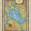
Lake Sunapee New Hampshire Historic Map There’s more to a lake than it simply being a body of water. Many lakes have helped to shape the vibrant history and culture of certain regions. Lakes provides environmental benefits, influence quality of life, strengthen economies through tourism, provide amazing opportunities for recreation and cottage/residential living, and serve […]

Discovery Map Series: The sites of Death Valley National Park, California

19 Feb
California_Death_Valley_Custom_Map_Art_1000_dpi_JPG_C-223-1KDPI-ECOM-GRAT_1 (1)

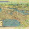
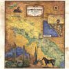
Straddling the California-Nevada border, Death Valley National Park occupies a desert valley area between the arid Great Basin and Mojave deserts. It is the hottest and driest place in America, and the lowest of all the national parks in the lower 48 states. Covering 3.3 million acres, this park features salt-flats, mysterious rocks, sand dunes, […]

Travel Tuesday Map: Adirondack State Park, New York

14 Feb
adirodack_correct_spelling

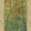
Among the many beautiful state parks in New York is the Adirondack Park. It was created in 1892 and is known for its diverse landscape that features pristine waterways, towering mountains and boreal forests. It’s earliest known human inhabitants were Paleo-Indians, evident from sites found around the region dating to 9,000 B.C. Escaping the chop […]

Discovery Map Series: Portolan Chart Of The Mediterranean And Connecting Seas 1550

12 Feb
portolean_chart_of_mediterreanean

It was in the year 1793 that Captain James Colnett of the Royal Navy set sail in the merchant ship Rattler to do a survey of the Galapagos Islands to investigate the possibilities of sperm-whale fisheries in the region. Colnett’s Chart of the Galapagos is the first fairly accurate map of the archipelago. It was […]

Travel Tuesday Map Series: Lakes of Sawyer County, Wisconsin

07 Feb
sawyercountybearmuskyfbdownload_0fdf286d-61db-4391-a7c4-e70c9ad299fb

Lakes of Sawyer County & Vicinity Wisconsin Historic Map There’s more to a lake than it simply being a body of water. Many lakes have helped to shape the vibrant history and culture of certain regions. Lakes provides environmental benefits, influence quality of life, strengthen economies through tourism, provide amazing opportunities for recreation and cottage/residential […]

Travel Tuesday Map Series: St. Lucie Inlet, Florida

31 Jan
image_9cf38cac-9c5b-4f40-b622-73238ab04c57

Immediately south of Jupiter Inlet Light in Palm Beach County, Florida is Jupiter Inlet, an opening in the beach, that leads to Jupiter Sound on the north, Loxahatchee River on the west, and Lake Worth Creek on the south. Fourteen miles south of St. Lucie Inlet, this turquoise runway to the Atlantic Ocean was originally […]