
Discovery Map Series: 037 Door County with Lighthouse Inset 1878
23
Feb
This well-executed Door County Map was originally published as part of the Historical Atlas of
Wisconsin in 1878 by Snyder, Van Vechten & Co., Milwaukee. It was a hand-colored lithographed
Atlas map with two insets showing townships, sections, rural buildings, etc.
The county takes it name from the passage between the tip of the peninsula and Washington Island.
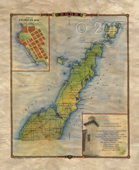
The early French called it Door of the Dead̢, which came to be referred to by Great Lakes sailors as Death’s Door.
All Sizes are approximate.
You will also love our antiquarian map collection! Click Here

No comments yet.