Archive | Map Art News

RSS feed for this section

Enjoy our archive of Lisa’s monthly newsletters

Discovery Map Series: Acadia National Park, Maine

29 Jan
bff12623-f6f5-5812-966d-43a40bc7197c

Acadia National Park is commonly referred to as the Crown Jewel of the North Atlantic Coast of the United States and is a national treasure of notable proportion located along the mid-section of the Maine coast. The park was established in January of 1929 and protects just under 50,000 acres, of which, roughly 35,332 acres […]

Travel Tuesday Map Feature: Yosemite National Park California

17 Jan
Yosemite

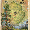
Yosemite National Park California Map Art Wall Decor Poster There are several natural wonders across America and the Yosemite National Park is one of the breathtaking beauties that continues to give charm abundantly. Naturalist, conservationist, and Scottish writer John Muir once said, “Yosemite Park… None can escape its charms. Its natural beauty cleans and warms […]

Discovery Map Series: Charlotte Harbor, Florida

08 Jan
charlotteharbor_floridaFBdownload

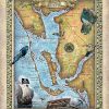
Charlotte Harbor, Lee County Florida boasts some of the most beautiful beaches that are the most popular attractions for visitors to this region of Florida’s coastline. Ponce de Leon is believed to have explored the barrier islands of Lee County when he ventured along Florida’s Gulf coast in 1513 and 1521. There was very little settlement […]

Discovery Map Series: Expedition Through The Rocky Mountains 1842

01 Jan
rocky_mountain_exploration

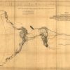
Called the “Pathfinder,” John Charles Fremont was a skilled surveyor, mathematician and explorer who ventured on important expeditions deep into the American West. His work “Map of an Exploring Expedition to the Rocky Mountains in the Year 1842 and to Oregon & North California in the Years, 1843-44” was a seminal one, published in 1845 in a […]

Discovery Map Series: History Of The Exploration Of The Colorado 1908

25 Dec
Grand_Canon_Colorado_River_11x14_Full-Bleed_1

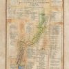
The Grand and other Cañons of the Colorado River of the West from 1540 to 1908 This is a very detailed exploration map of the Colorado River and Grand Canyon, published in 1908 by Robert Brewster Staton. Staton was a civil and mining engineer. In 1889-1890, Staton carried out the Survey for the “Denver Colorado Cañon and Pacific Railway,” […]

Travel Tuesday Map Series: Lakes of Sawyer County and Vicinity, Wisconsin

20 Dec
b20f7015-f3a4-5a3b-836f-65e637b3efae

Lakes of Sawyer County & Vicinity Wisconsin Historic Map There’s more to a lake than it simply being a body of water. Many lakes have helped to shape the vibrant history and culture of certain regions. Lakes provides environmental benefits, influence quality of life, strengthen economies through tourism, provide amazing opportunities for recreation and cottage/residential […]