The fourth longest river in the U.S., the Rio Grande, originates in the Rocky Mountains at the southwestern part of Colorado, twisting like a snake across the Southwest, passing through fertile valleys, amazing canyons, mountains, and desert shelves, and eventually emptying into the Gulf of Mexico Early occupants of the Rio Grande region were Native […]
Archive by Author
Snagging the attention of millennials

Don’t be afraid of this fun-loving bunch! Recent marketing and sales trends indicate: it’s now advised we start product development and merchandising to those pesky Millennials! Surprisingly they spend less time on social media and prefer to shop in person! Enhancing Millennial Customer Interaction Millennials have become the demographic that is driving marketing strategies for […]
Travel Map Feature: 269-San Juan Island, Salish Sea
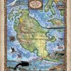
Forget about a tropical retreat for a moment and think of a panoramic valley, dotted with cows, vineyards, iconic lighthouses, whale watching in the distance, and lush forest. San Juan Island is one of four islands, and the second-largest of the San Juan Archipelago, located in the northwest region of the contiguous United States between the […]
Discovery Map Series: Africae Accuratissima
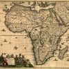
An early map of Africa, Totius Africæ Accuratissima Tabula, is believed to have been published in Amsterdam in 1688 and is the work of Fredrik de Wit. Who was Fredrik de Wit? Born in Gouda, Netherlands, Wit was a Dutch cartographer, who was active during the second half of the 17th and the early 18th […]
Discovery Map Series: Africa
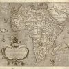
Arnoldo di Arnoldi’s map, simply titled Africa was published in Siena, Italy in 1600 by Matteo Florimi, an Italian print seller, book dealer and publisher. Arnoldi was a Flemish artist and cartographer, who, at the end of the 16th century, carried on his work in Bologna and Siena. He was the leading engraver and mapmaker […]
Travel Map Feature: North and South Hutchinson Island
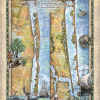
Hutchinson Island is known for its beautiful, pristine, sandy beaches, nature preserves and parks. The long, thin island stretches for 23 miles and is over a mile wide at various points. It is situated roughly Northwest to Southeast and bounded by the Atlantic Ocean on the east, and the Indian River on the west, the […]
Discovery Map Series: The Mitchell Map
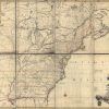
The Mitchell Map, or Map of the British and French Dominions in North America, believed to have been created in 1754 or 1755, is the work of John Mitchell, who came from a wealthy Virginian family. He was not a professional cartographer by trade, and his formal education was in medicine and botany. His map was […]
Discovery Map Series: 037 Door County with Lighthouse Inset 1878
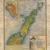
This well-executed Door County Map was originally published as part of the Historical Atlas of Wisconsin in 1878 by Snyder, Van Vechten & Co., Milwaukee. It was a hand-colored lithographed Atlas map with two insets showing townships, sections, rural buildings, etc. The county takes it name from the passage between the tip of the peninsula […]
Weekly Map Giveaway Winner!
Sign up for our weekly map give-away here! This week’s mystery winner is… allenrach22@ If your email address starts with “allenrach22″ please email me at: [email protected] to claim your free map! The entire email address has been omitted for your privacy. The name on this page is changed weekly, and chosen with “randomnamepicker.org” Thank you […]
Weekly Map Giveaway Winner!
Sign up for our weekly map give-away here! This week’s mystery winner is… cheryl49866@ If your email address starts with “cheryl49866″ please email me at: [email protected] to claim your free map! The entire email address has been omitted for your privacy. The name on this page is changed weekly, and chosen with “randomnamepicker.org” Thank you […]

Follow Us!