
Discovery Map Series: 003 1846 Railroad Map Featuring Many Northeastern States Rhode Island Connecticut Massachusetts
This 1846 map features several states on the north eastern seaboard. This was a time in our history when towns and cities were springing up in populated areas as expansion and industry took root. However, if you look closely at this map, it appears that much of the topography, and landmarks, are missing. The reason? This is a railroad map. It features well traveled popular routes for plotting and planning rail travel. As such, many of the items that are common to other maps are noticeably absent on this one.
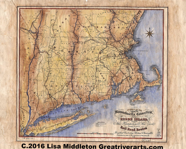
This would have been a useful trip aid for both passengers and business owners. To give you an idea of just how useful, at the time this map was produced, there were 15+ railroad companies that existed in the state of Massachusetts alone. They all traveled the same routes and had different schedules. Many of these carried passengers, freight, or a combination of the two. To ride the rails, you had to know the railroad company you were using for travel, as well as the routes they would run. A railroad map made life a lot easier.
All Sizes are approximate.
You will also love our antiquarian map collection! Click Here

No comments yet.