Archive | Featured Article

RSS feed for this section

Travel Tuesday Map Feature:Jupiter Inlet, Florida

28 Sep
jupiter_inlet

Immediately south of Jupiter Inlet Light in Palm Beach County, Florida is Jupiter Inlet, an opening in the beach, that leads to Jupiter Sound on the north, Loxahatchee River on the west, and Lake Worth Creek on the south. Fourteen miles south of St. Lucie Inlet, this turquoise runway to the Atlantic Ocean was originally […]

Discovery Map Series : Antarctic Exploration – America, noviter delineata 1622

26 Sep
June4Edu

The America, Noviter Delineata map, published in 1622, is the work of Jodocus Hondius (1563-1612) and Jan Jansson (1588-1664). Jodocus Hondius, also called “the Elder,” was a Flemish cartographer and publisher, who made a name for himself in Ghent, where he worked as an engraver and globe maker. In 1584, Hondius fled to London during the Eighty […]

Discovery Map Series: The Lost Map of Joliet

19 Sep
joliet_grande

The story told is that upon returning to Montreal, Canada, following his exploration of the Great Lakes and the Mississippi River 1673-1674, with Jesuit missionary Jacques Marquette, Louis Joliet, at the request of French officials, drew from memory the “Nouvelle decouverte de plusieurs nations dans la Nouvelle France en l’année 1673 et 1674”, translated “New […]

Travel Map Feature: 221 Custom map of The Historical Landmarks of Santa Fe

07 Sep
Santa Fe

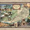
Santa Fe, New Mexico Santa Fe, meaning holy faith in Spanish, was founded between 1607 and 1610 by Spanish colonists, and is the highest in elevation and oldest state capital in the United States. At an altitude over 7,000 feet situated in the foothills of the southern Rocky Mountains, Santa Fe is New Mexico’s fourth […]

Discovery Map Series: 016 Arizona Wagon Roads 1879

22 Aug
April 2 Education

This is a historic railroad map of the proposed state, created in 1876, with the proposed state outlined in yellow.. However, it also shows us stage lines, roads, trails, a proposed mail route, and propose railroad lines in addition to those already existing. The mail route would open up future business and grease the wheels […]

Discovery Map Series: 025 Canyons of the Colorado, Arizona 1906

15 Aug
April 3 Education

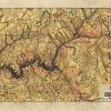
Extremely beautiful colorization of Bartholomew’s Canyons of the Colorado 1906 map. Features Grand Canyon. One of Lisa’s favorites. Other sizes are available, as well as originals. Lisa’s maps are known to be some of the most beautiful hand painted maps available. All sizes are approximate. Order Your Own Copy Here For more maps in our […]

Discovery Map Series: 003 1846 Railroad Map Featuring Many Northeastern States Rhode Island Connecticut Massachusetts

25 Jul
3.Education

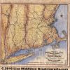
This 1846 map features several states on the north eastern seaboard. This was a time in our history when towns and cities were springing up in populated areas as expansion and industry took root. However, if you look closely at this map, it appears that much of the topography, and landmarks, are missing. The reason? […]

Travel Map Feature: Lake Michigan

13 Jul
4. Travel

The third largest of the gems that are the Great Lakes of North America, Lake Michigan is a natural lake entirely sheltered within the borders of the United States, and touches the states of Michigan, Wisconsin, Illinois and Indiana. Its name originates in the Ojibwa (Chippewa) word “michi- gami,” meaning “large lake.” At roughly 22,300 square miles, […]

Weekly Map Giveaway Winner!

12 Jun

Sign up for our weekly map give-away here! This week’s mystery winner is… aaron.kohlheep@ If your email address starts with “aaron.kohlheep@ please email me at: [email protected] to claim your free map! The entire email address has been omitted for your privacy. The name on this page is changed weekly, and chosen with random.org. Thank you […]