Archive | Map Art News

RSS feed for this section

Enjoy our archive of Lisa’s monthly newsletters

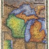
Michigan and Wisconsin, 1858

04 May
Michigan and Wisconsin

  Map of Michigan and Wisconsin 1858 This is a beautiful map of Michigan and Wisconsin that utilizing a copperplate engraving method. This was quite popular during that time period, and often times copper plates were bought and sold just as common pieces of construction machinery are today. They were interchangeable and could be used […]

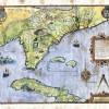
The Spanish Trail

01 Apr

On one of my favorite maps in my collection two trails are prominently posted- the Hudson Bay Trail and the Spanish Trail. After spending a month in Arizona exhibiting in art shows my interest was piqued…what was the Spanish trail and what legends does it contain? In the early to mid-1800s, the Spanish Trail gained […]

Tell your neighbors! Tell your friends!

29 Jul

Lisa’s Summer Show Schedule 2014 Conference, Jackson WY October 4-5: Issaquah Salmon Days, Issaquah WA (waiting list) October 24-26 Best of the Northwest, Seattle WA “I have seen your maps EVERYWHERE and have been so looking forward to buying one for myself!” “I LOVE this map, I KNEW the Scottish were here!” Explore Lisa’s maps […]

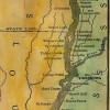
Our “NEW MAP OF LAKE PEPIN ON THE MISSISSIPPI RIVER” is now available!

14 May

Our beautiful “New Map of Lake Pepin” drawn and illustrated by Wisconsin Map Artist, Lisa Middleton, is shown here framed. The 11×34″ gift prints are now available at better gift shops along both shores of Lake Pepin for about $24.95. Or call us at 888-255-7726 to order! The map, based on current USACE river charts is […]

1878 Historic Door County Map Features Lighthouse Inset

07 May

Today we are featuring our NEW 1878 Door County Wisconsin Atlas Map–it notes the location of each lighthouse at that time, all townships, villages, and sections, and a street plan for Sturgeon Bay in the upper left inset. While the original map featured Jenny, Wisconsin (of Lincoln County), in the lower right, we have provided […]