Travel Tuesday Map Feature: The Sites Of Death Valley National Park, California

18 Aug
death_valley

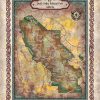
Straddling the California-Nevada border, Death Valley National Park occupies a desert valley area between the arid Great Basin and Mojave deserts. It is the hottest and driest place in America, and the lowest of all the national parks in the lower 48 states. Covering 3.3 million acres, this park features salt-flats, mysterious rocks, sand dunes, […]

Discovery Map Series: Earliest Chart Of The Galapagos A. Arrowsmith, 1798

16 Aug

It was in the year 1793 that Captain James Colnett of the Royal Navy set sail in the merchant ship Rattler to do a survey of the Galapagos Islands to investigate the possibilities of sperm-whale fisheries in the region. Colnett’s Chart of the Galapagos is the first fairly accurate map of the archipelago. It was […]

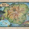
Discovery Map Series: Historic Hawaii Collection

26 Jul
Hawaii_4x6

Hawaii has a rich history and culture shaped by an enduring heritage, struggle and its natural environment. Cartography has helped to convey important aspects of the Hawaiian story, particularly as it relates to politics. Before the Kingdom of Hawaii became a territory in 1900, it had enjoyed sovereignty through monarchical rule for some 100 years. […]

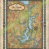
Travel Map Feature: Lake Keowee, South Carolina

14 Jul
huge_map_old_map_retro_lake_keowee

The Lake Keowee region supports a diverse flora and fauna. Aquatic plants include alligatorweed, coon’s tail, waterweed, while common species of trees comprises bald cypress, water tupelo, red maple, sweetgum, water ash and water oak. An abundance of fish can be found in Lake Keowee, including carp, spotted sucker, redbreast sunfish, silver redhorse, spottail shiner, […]

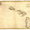
Discovery Map Series: Na Mokupuni O Hawaii Nei Historical Map Of Hawaii 1837

12 Jul
Na_mokupuni_O_Hawaii_Nei_Historical_map_of_Hawaii_1837

The map “Na mokupuni O Hawaii Nei,” published in 1837 by Kulanui Lahainaluna, Maui is the first separate map of the Hawaiian Islands published in Hawaii and the first Hawaiian-language map of the islands. It is the work of Simona P. Kalama, who engraved and drew the map. Kalama was a top student engraver at […]

Discovery Map Series: 050 Hawaii 1906, Bartholomew

05 Jul
Hawaii_4x6

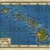
This hand-painted map, Hawaii, 1906, is derived from the work of John Bartholomew of Edinburgh, Scotland. Bartholomew was a cartographer, as well as a map and atlas publisher, who emerged from a renowned line of map-makers that created the map-making business that was known as John Bartholomew and Son Ltd. Along with his brothers, Peter […]

Discovery Map Series: Exploration of Antarctica

28 Jun
june1edu

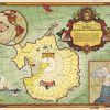
No map collection is complete without a nod in direction of Antarctican maps, the steely continent yet unmastered by men, the historic maps of which still allude to mysteries both known and unknown. Before the turn of the 20th century, there was limited exploration and scientific activity on and around the Antarctic continent. Exploration campaigns […]

Discovery Map Series: Authorized map of the Second Byrd Antarctic Expedition 1934

21 Jun
June3Edu

Issued by the General Food Corporation in 1934, the work “Authorized Map of the Second Byrd Antarctic Expedition” is a fascinating, colored pictorial map that focuses on the exploration and discovery of Antarctica and Richard E. Byrd’s role in the adventure. Byrd was an explorer and naval aviator, who became a pioneer in navigating long […]