Discovery Map Series: Dungeness Spit, Washington

09 Oct
dungeness_spit_facebook_download

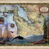
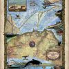
Stretching for roughly 6 miles east of Port Angeles and jutting into the Strait of Juan de Fuca, Dungeness Spit is the longest natural sand spit in the United States. This narrow strip of landform in northeastern Clallam County, Washington shelters the Dungeness Bay. Dungeness Spit is situated entirely within the Dungeness National Wildlife Refuge, […]

Discovery Map Series: Petoski Lakes, Beaver Island, and Traverse Bay Michigan

02 Oct
traverse_bay_water (1)

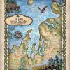
Michigan is known as the Great Lakes State, and the name Michigan comes from the Native American word “Mishigamaa” which means “large lake.” Its beautiful, natural surroundings include 3,177 miles of Great Lakes shoreline, along with numerous other exquisite lakes, almost 200 waterfalls and 36,000 miles of streams, along with numerous islands. It can simply […]

Travel Tuesday Map Series: Outer Banks, North Carolina

27 Sep
afe2df81-0168-53b6-9d94-4384f65db80c

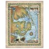
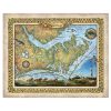
This carefully researched and exquisitely colored map of the Outer Banks, North Carolina is a, exquisitely rare jewel! New to the internet and gift shops this marvelous map is colored majestically and researched carefully. It will look great in guest rooms, foyers, and even bathrooms! Great as a gift for new residents or your own […]

Discovery Map Series: Nantucket, Massachusetts

25 Sep
T-167

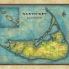
Delightfully colored with ocean blue, this Massachusetts wall art features modern data, but boasts a very classic and historic layout. Nantucket is a tiny island with sunbaked, perfectly windswept, beautiful beaches and this Massachusetts map doesn’t disappoint. The whimsical motion that Lisa brings to this print makes it the perfect gift for any Massachusetts native. […]

Weekly Map Giveaway Winner!

24 Sep

Sign up for our weekly map give-away here! This week’s mystery winner is… lscorza@ If your email address starts with “lscorza” please email me at: [email protected] to claim your free map! The entire email address has been omitted for your privacy. The name on this page is changed weekly, and chosen with random.org. Thank you […]

Discovery Map Series: Hiking Trail Of Yellowstone National Park

18 Sep
GRA - What makes fine art prints special R4

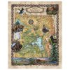
Yellowstone National Park Hiking Trails Largely situated in Wyoming and extending into Idaho and Montana, the Yellowstone National Park is a natural, scientific, and scenic unspoiled beauty. In 1872, it became the first national park in the United States covering an area of more than 3, 400 square miles. Yellowstone National Park was home to […]

Travel Tuesday Map Series: Beaufort Map, North Carolina

13 Sep
0c3f3d6e-ea14-5d40-990a-b3a5bfaa2164

Invite this gorgeous North Carolina map into your home today. Carefully researched and exquisitely colorized with our distinctive and inviting colors, this vintage map of the breathtaking Crystal Coast in North Carolina is a great gift for a traveler, a housewarming gift, or just for you in your regional home. Please read more about the […]

Discovery Map Series: Bob Marshall Spotted Bear Montana Historic Map Art Print

11 Sep
GRA - What makes fine art prints special R4

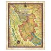
Named in honor of the early wilderness advocate, the Bob Marshall Wilderness complex includes three wilderness areas and is surrounded by protected lands totaling more than 2.54 million acres. This wild and roadless wilderness train is only accessible in the company of mountain men and those who seek to learn quickly the ways of the […]