Archive | Featured Article

RSS feed for this section

Travel Tuesday Map Feature: Savannah and Tybee Island

30 Aug
watermarked savannah

Use discount code SAV to get 50% off!  Affectionately dubbed the “The Hostess City of the South,” Savannah was established in 1733 and is known to be the oldest city in the State of Georgia, and America’s first planned city, which still maintain 22 of its 24 original squares today. The name Savannah is believed to […]

Discovery Map Series: Columbia River, Headwaters to the Pacific Ocean

28 Aug
Columbia-River_1

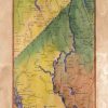
Columbia River Whether it is called the River Oregon, Big River, or River of the West, the Columbia River is the largest river in North America that drains into the Pacific Ocean. The Columbia River drains a basin that is approximately 260,000 square miles, from its headwaters in the Rocky Mountains of British Columbia, Canada […]

Travel Map Feature: 208 Custom map of Hawaii Waterfalls, Beaches, and Natural Lands

23 Aug
2.Travel

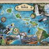
Out in the middle of the Pacific Ocean lies Hawaii, home to one of the world’s most active volcanoes and the tallest sea mountain in the world. This chain of islands is roughly 2000 miles  (3200 kilometers) from the coast of the Continental United States. Hawaii is made up of eight major islands and more than […]

Discovery map Series: California’s First Appearance on a Map!

21 Aug
AMERICAE_SIVE_36x45_084ceea2-fc3c-4d71-a1a7-9fddef92b047_grande

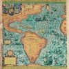
Join us every Sunday night for our Discovery Map Series! For a century, Americae Sive Quartae Orbis Partis Nova Et Exactissima Descriptio (A New and Most Exact Description of America or The Fourth Part of the World) remained the largest map of the Americas. The number of copies that were printed for circulation is unknown, […]

Travel Map Feature: 171 The Bahama Out Islands

16 Aug
June4Travel

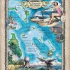
Rich in history, culture, heritage, and tranquil natural beauty, the Out Islands of the Bahamas calls to the connoisseurs of Caribbean island life, and those individuals who desire to retreat to a place that seemingly slows in time and offers up naturally wondrous  untainted pieces of paradise. The Out Islands of the Bahamas makes up […]

Discovery Map Series: Piri Reis Map – The Mystery of Antarctican Exploration

14 Aug
June2Edu

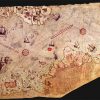
Piri Reis Map, 1513, is considered to be a world map, but portions of the map is missing, with only about one third of the map surviving today. The significance of the map is relevant to the history of the exploration of the New World or the Western Hemisphere. It is believed that the map […]

Discovery Map Series: Portolan Chart Of The Mediterranean And Connecting Seas 1550

07 Aug
portolean_chart_of_mediterreanean

It was in the year 1793 that Captain James Colnett of the Royal Navy set sail in the merchant ship Rattler to do a survey of the Galapagos Islands to investigate the possibilities of sperm-whale fisheries in the region. Colnett’s Chart of the Galapagos is the first fairly accurate map of the archipelago. It was […]

Travel Map Feature: Lake Norman, North Carolina

02 Aug
3.2 Travel Map

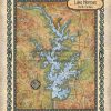
The Lake Norman region supports a diverse flora and fauna. Aquatic plants include alligatorweed, coon’s tail, waterweed, while common species of trees comprises bald cypress, water tupelo, red maple, sweetgum, water ash and water oak. An abundance of fish can be found in Lake Norman, including carp, spotted sucker, redbreast sunfish, silver redhorse, spottail shiner, […]

Discovery Map Series: Map Of The Hawaiian Islands 1876

31 Jul
hawaii_1876

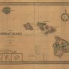
Under the direction of William D. Anderson, Surveyor General of the Hawaiian Government Survey, Map of the Hawaiian Islands, 1876 was created and published for the celebration of the 100th anniversary of American independence by J. L. Smith Co. More specifically, it was for the Hawaiian Exhibit at the International Exhibition of Arts, Manufactures and Products […]