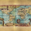
To Be updated! The Age of Discovery and Exploration began around the 15th Century. Over the centuries there were many technical advancements in ship and map making and they reached an apex for most Europeans (save the Vikings) in the 1400’s. The Age of Discovery largely began with the King of Portugal known as Henry […]
Archive | Map Art News
RSS feed for this sectionEnjoy our archive of Lisa’s monthly newsletters
EDUCATIONAL MAP FEATURE : THE LOST MAP OF SIR FRANCIS DRAKE

Originally produced by Dutch cartographer and engraver Nicola van Sype, and perhaps published in Antwerp in 1581, La herdike enterprise faict par le Signeur Draeck D’Avoir cirquit toute la Terre is believed to be drawn from a copy of the Queen’s map, also known as the “Whitehall Map,” a large scale map that Francis […]
Custom Framing to the Rescue!

Easy frame option upgrade! Upgrade to a finished gift ready to display in any room! Our frames are solid wood, framed with glass, and include historical statement. The frames are built in and shipped from Holmen, WI. Please be sure to choose the size frame that coincides with the size of your print. If you […]
Show your Map Love!

If you’re like us (and we suspect you are) you’re not afraid to show your MAP LOVE! From now on when you order from us every order will include a very mappy magnet! I don’t know about you- but I think our new magnets are cuter […]
New! Beautiful Map series of The South Carolina Coast!
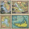
Join us on our newest map series! Carolina Coasts Maps! Mix and match for your truly unique ensemble! Hilton Head, South Carolina BUY NOW! Charleston Including Isle of Palms and Kiawah BUY NOW! Beaufort and the Sea Islands, South Carolina BUY NOW! Make it Easy With our custom framing services! Free shipping for the […]
Memories will fade, but maps stay forever

“It’s a rainy Saturday night. Me and my husband cuddle up on the couch with a blanket. Our eyes are drawn to the map across the living room and we start to reminisce. The red dot, the place where it all started. Vienna. The city of my dreams. Since I was little, I wanted to […]
Announcing Our 3rd November Raffle Winner
WEEK 3 OF OUR HOLIDAY RAFFLE SERIES Our NEXT RAFFLE WINNER will be announced 11/27/17. Stay tuned! If you have not told us which map you’d like to win, yet tell us now! Not part of our Holiday raffle series, yet? Sign Up Now! Black Friday Sales Are Coming! Free Maps. Great Discounts. Instant Savings! […]
Steam and Rail Anthologies by Celebrated Author Michael Gillespie

BUNDLE AND SAVE More than $25! Limited time offer! Michael Gillespie’s 5-book River and Rail Steam Bundle! A $110 Gift Pack of our Most Popular Paperback Transportation books for Just $90! A perfect match for Lisa Middleton’s historic maps from the turn of the 19th and 20th centuries! Paperback series of Mike Gillespie’s most beloved […]
November Note from Lisa

I’ve started my winter travel season! I will be stopping in Florida, Las Cruses, Quartzsite, Palm Springs, San Francisco and then right up the Oregon Coast! Lots of opportunities to get inspiration for new maps. Please follow me on Facebook and Instagram as I share my adventures and new maps. Hoping for safe winter adventures […]

Follow Us!