Archive | mappa monday!

RSS feed for this section

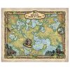
Discovery Map Series: A Suggested Route Great Lakes through Rhode Island

23 Oct

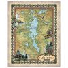
If ever one could suggest a route to travel and enjoy on the waters right inside “The Great U.S of A”, Chicago, Illinois to Warren, Rhode Island should be at the top of the list. Who dreams of sailing between Chicago and Rhode Island? Yes, sailing… Such a dream is more than possible. Watery pathways […]

Weekly Map Giveaway Winner!

22 Oct

Sign up for our weekly map give-away here! This week’s mystery winner is… bennyburger@ If your email address starts with “bennyburger” please email me at: [email protected] to claim your free map! The entire email address has been omitted for your privacy. The name on this page is changed weekly, and chosen with random.org. Thank you […]

Travel Tuesday Map Feature: 269-San Juan Island, Salish Sea

18 Oct
San Juan

Forget about a tropical retreat for a moment and think of a panoramic valley, dotted with cows, vineyards, iconic lighthouses, whale watching in the distance, and lush forest. San Juan Island is one of four islands, and the second-largest of the San Juan Archipelago, located in the northwest region of the contiguous United States between the […]

Discovery Map Series: 126 Upper Territories of the United States 1814

16 Oct
Upper_Territories_4x6_1

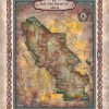
This 1814 map of the upper territories of the United States depicts a time in our nation’s history when fur trade was the order of the day. The fur trade had it roots in Wisconsin and began to spread west over time. States such as Illinois, Indiana, Ohio, and Michigan were known for their involvement […]

Discovery Map Series: Dungeness Spit, Washington

09 Oct
dungeness_spit_facebook_download

Stretching for roughly 6 miles east of Port Angeles and jutting into the Strait of Juan de Fuca, Dungeness Spit is the longest natural sand spit in the United States. This narrow strip of landform in northeastern Clallam County, Washington shelters the Dungeness Bay. Dungeness Spit is situated entirely within the Dungeness National Wildlife Refuge, […]

Discovery Map Series: Petoski Lakes, Beaver Island, and Traverse Bay Michigan

02 Oct
traverse_bay_water (1)

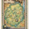
Michigan is known as the Great Lakes State, and the name Michigan comes from the Native American word “Mishigamaa” which means “large lake.” Its beautiful, natural surroundings include 3,177 miles of Great Lakes shoreline, along with numerous other exquisite lakes, almost 200 waterfalls and 36,000 miles of streams, along with numerous islands. It can simply […]

Travel Tuesday Map Series: Outer Banks, North Carolina

27 Sep
afe2df81-0168-53b6-9d94-4384f65db80c

This carefully researched and exquisitely colored map of the Outer Banks, North Carolina is a, exquisitely rare jewel! New to the internet and gift shops this marvelous map is colored majestically and researched carefully. It will look great in guest rooms, foyers, and even bathrooms! Great as a gift for new residents or your own […]