
Educational Map Series: The Most Important Regional Map of America in the 17th Century
Believed to have been published in Amsterdam in 1642, Nova Virginiae Tabvla is the work of Flemish cartographer and engraver Hendrik Hondius. Hondius was apprenticed to Godfried van Ghelder in Brussels, studied drawing with the engraver Jan Wierix of Antwerp, and he also studied engraving along the way, to which he dedicated himself as a practice. In 1599, he became the first publisher to be granted a national privilege by the States General of the Netherlands, allowing protection against the circulation of copies of his published works in the Dutch Republic. This early map of Virginia and the Chesapeake Bay was an important 17th Century regional map of America to have circulated at the time.
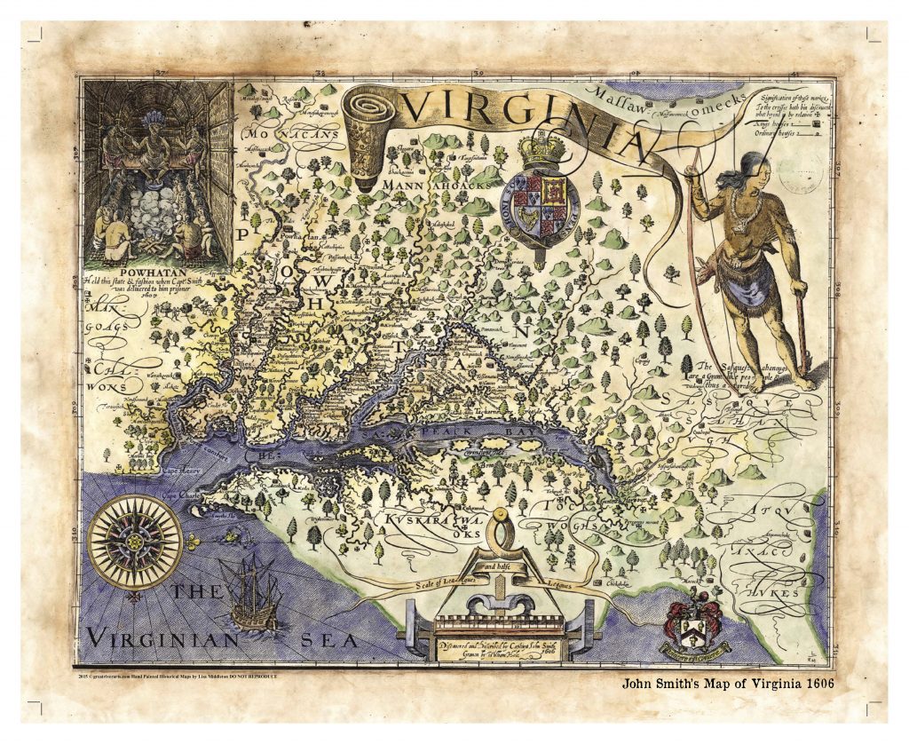
Hondius’ map is a derivative of the cartographic work of English explorer and Captain John Smith (1580-1631), specifically his original 1612 landmark map of the Virginia Colony, which remained in active use up until Augustine Hermanns’ map of 1673, and facilitated European exploration of the Virginia and Chesapeake region. In 1618, Hendrik’s deceased brother Jodocus Hondius’ drew and engraved a version of Smith’s map, which was bought by competing Dutch cartographer, Willem Blaeu in 1629. This map was a vital source of information during its time, and was circulated throughout Europe in the 17th century, providing knowledge of the English settlements in Powhatan’s territory.
There are many notable depictions on the Nova Virginiae Tabvla, including the Chesapeake Bay and its tributaries, and the appearance of islands in the Bay, such as Ruffels Iles and Smyths Iles. The map is highly detailed with landform, indicative of mountain ranges (Peregryns Mount, for example) throughout the entire region. Filling the map are countless names of Native American villages situated on the banks of rivers in the region, along with the names of various tribes, like the Mangoags, Chawons, Powhatan, Mannahoacks and Monacans.
Icons representative of the various locations of buildings, settlements, and English towns are provided in a cartouche. Featured in the upper left hand corner is a Powhatan Indian chief resting on his throne and his council seated below his feet. In the upper right corner is the Royal British coat of arms, and beneath that is a lone Indian holding a club and a bow- perhaps a warrior. A compass rose with multiple rhumb lines is situated in the lower left corner, with north pointed to the right and not at the top as is typical on maps today. This map was not simply an exploratory tool, but a navigation resource for sailors as well.
Please join us Sunday Nights for a new Educational Map Feature!
You may also like:
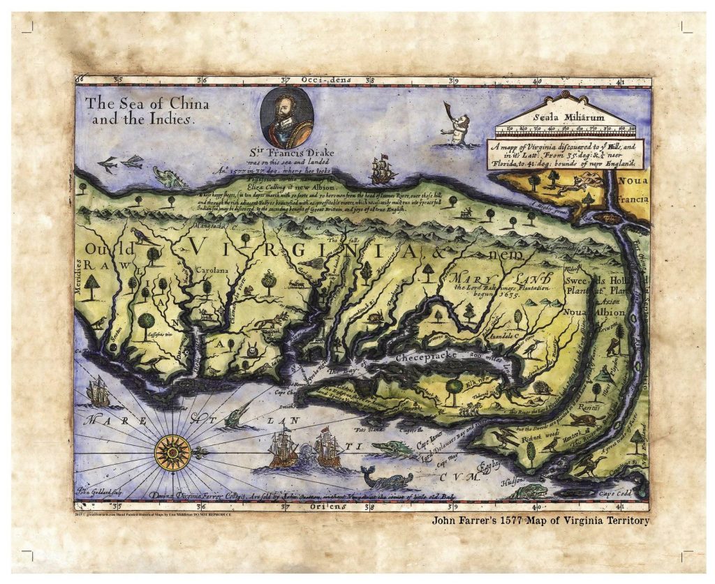
JOHN FARRER’S 1577 MAP OF THE VIRGINIA TERRITORY
This early map of the Virginia Territory is significant due to its depiction of North America. If you notice, our continent looks rather narrow. Furthermore, there is a strange Northwest passage in the form of a river that connects the Hudson to the “sea of China and the Indies”. Of course, further cartographic efforts, coupled with years of exploration, would render a true and more accurate shape. Yet, this John Farrer original is widely regarded as an important piece of history more than anything else. He was an ardent promoter of the Virginia colony. He was such a fan that he named his daughter after it. This map was originally hand drawn, and included in his personal copy of Virgo Triumphans, known in English as Virginia Richly and Truly Valued, by Edward Williams. Yet neither he or Farrer is featured in the cameo at the top. That is Sir Francis Drake, who is credited for exploring much of the east coast before it was developed or claimed.
No comments yet.