
Proud to offer: 1732 Cart De La Louisiane-French map of the NORTHWEST PASSAGE!
17
Feb
1732 Cart De La Louisiane by Delisle

We are so pleased to offer a beautifully painted version of the the 1732 Cart De La Louisiane Et Du Cours Du Mississippi by Delisle.
One of the original prints, seen below, is sold for $3,000 on a map website. We are pleased to offer it for a price range between $3.50 (magnet size) to $285 for a 36″ version.
It is known to be one of the most important illustrations of North America ever published. It was one of the oldest maps consulted by Lewis and Clark when planning their expedition.
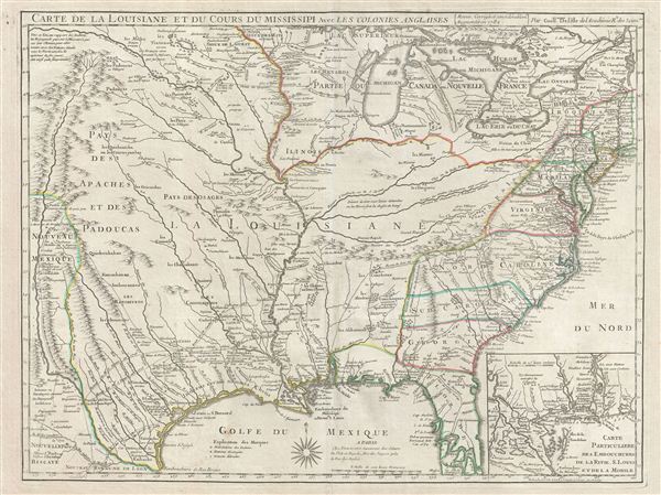
You’ll notice that the Missouri River Connects over the top of the Rocky Mountains, implying that it connects to the other side of the continent. You’ll also notice “River De Norte” connecting from what appears to be Glacier National Park to the Golfe Du Mexique!!
This map is known for it’s accuracy on the eastern seaboard and up the Mississippi River Delta. Why wouldn’t the hopeful explorers believe it when it represented another Mississippi River on the West side of the mountains? They must have trusted the map because it was so accurate in some areas. Today we see that it was just wishful thinking!
Up close you’ll also see the routes of earlier explorers dating from 1540.
This is one of our prized early maps. Please keep checking back for more maps as we release our western collection, and a beautiful Lewis and Clark map.
You can purchase this map and others by calling 1888-255-7726
You can also visit our websites:
www.greatriver.com
www.greatriverarts.com
and our Facebook pages under Great River and Great River Arts
No comments yet.