Discovery Map Series: 147 Zachary Taylor’s Seat of War in Florida, 1839

26 Dec
Floridia-Seat

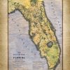
This map was produced by the United States Bureau of topographical engineers in the year 1839. It was produced at the order of Brvt. Brig. General Z. Taylor depicting the territory of what would later become the state of Florida. Much detail went into its creation by the Bureau of topographical engineers. If you look closely you […]

Travel Tuesday Map Feature: 287-Ornate Flathead Lake, Montana Designed and Painted by Lisa Middleton

21 Dec
Flathead_Lake_36x45_3

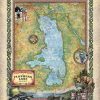
Flathead Lake, with a surface area of up to 197 square miles, is the largest natural freshwater lake west of the Mississippi River in the continental United States. The lake is roughly 27 miles long and 15.5 miles wide at its widest point. It has an average depth of 165 feet, but a maximum depth […]

Discovery Map Series: 039 Father of Waters 1887 Mississippi River

19 Dec
retroMap-Father-of-Water-_1

This reproduction of a rare Mississippi River “ribbon map” was drawn by Captain Willard Glazier to “prove” his premise that the True Source of the Mississippi was Lake Glazier rather than Lake Itasca. Looking for modern day towns on an old map? Many modern-day towns are included in this. It also contains many towns noted […]

Discovery Map Series: 069 Les Etats Unis 1781

12 Dec
Les_Etats_Unis

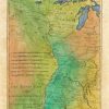
This map is expertly drawn and features the region that stretches from the Mississippi Valley upwards towards the Appalachian Mountains. This map was drawn right around the time of the American Revolution by French mapmaker Rigoberto Bonne. Bonne was a noted cartographer of his day in that his works begin to detour from the traditional […]

Discovery Map Series: 064 La Florida 1570

05 Dec
La_Florida

La Florida Gvastecan Pervviae Avriferae Regionis Typvs Born in Antwerp Belgium in 1527, Abraham Ortelius was one of the most non-assuming influential cartographers the craft has ever seen. He was so non-assuming that his tombstone in Antwerp reads…Quietis Cultor sine bit, uxore, prole, which means, served quietly, without accusation, wife, and offspring. While he was […]

Discovery Map Series: Nova Totius Terrarum 1605

28 Nov
Antique_World_Map_Nova_Totius_Hand_Painted_1000_dpi_JPG_H-135-1KDPI-ECOM-GRAT_1

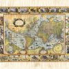
Willem Blaeu’s (Nova Totius Terrarum Orbis Geographica ac Hydrographica Tabula) This map is the first exciting rendition of MERCATOR’s projection map, the first style of map to put the Prime Meridian across the center of the map, thusly avoiding the awkwardness of a series of circles. Is is a fine example of the golden age […]