OLD MAP STUDIES: A Timeline of The Age of Discovery and Notable Explorations

07 Feb

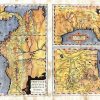
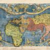
To Be updated! The Age of Discovery and Exploration began around the 15th Century. Over the centuries there were many technical advancements in ship and map making and they reached an apex for most Europeans (save the Vikings) in the 1400’s. The Age of Discovery largely began with the King of Portugal known as Henry […]

EDUCATIONAL MAP FEATURE : THE LOST MAP OF SIR FRANCIS DRAKE

04 Feb
the lost map of drake small jpg

  Originally produced by Dutch cartographer and engraver Nicola van Sype, and perhaps published in Antwerp in 1581, La herdike enterprise faict par le Signeur Draeck D’Avoir cirquit toute la Terre is believed to be drawn from a copy of the Queen’s map, also known as the “Whitehall Map,” a large scale map that Francis […]

Are you in Love With Flathead Valley?

22 Jan
13177620_10208138794002034_5368876059485203763_n

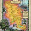
In Love with Montana and the Flathead Valley? Add some Big Sky to your home or office with our Montana map collection! 287-Ornate Flathead Lake, Montana Designed and Painted by Lisa Middleton 158 Hiking trails of Glacier National Park Custom Designed by Lisa Middleton 288-Flathead Valley, Montana 135 Whitefish Lake, Montana Custom map Designed By […]

New! Beautiful Map series of The South Carolina Coast!

21 Dec

Join us on our newest map series! Carolina Coasts Maps! Mix and match for your truly unique ensemble! Hilton Head, South Carolina BUY NOW! Charleston Including Isle of Palms and Kiawah BUY NOW! Beaufort and the Sea Islands, South Carolina BUY NOW!   Make it Easy With our custom framing services! Free shipping for the […]