Archive | Featured Article

RSS feed for this section

A Chart of England, Scotland, France, and Ireland

21 Mar
iiif-service_gmd_gmd3m_g3201m_g3201pm_gct00234_ca000013-full-pct_12.5-0-default

A Chart of England, Scotland, France, and Ireland is the shortened name of a portolan chart that goes by a couple of other names, including “Sea-atlas, Containing an Hydrographical Description of the Sea-coasts of Most of the Known Parts of the World.” It was published in 1700 in London by John Thornton, who was a […]

Tuesday Travel Feature: Custom Map Of The Space Coast

16 Mar
Untitled

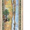
  Florida’s Space Coast Situated approximately 35 miles east of Orlando and with over 75 miles of beach along Florida’s Atlantic Coast, which stretches from Canaveral National Seashore south to Vero Beach, Florida’s Space Coast is sometimes characterized as a multigenerational destination, with incredible diversity from North to South. This diversity is evident through Space […]

Hiberniae Britannicae

15 Mar
Hiberniae

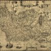
This‌‌ ‌Abraham‌ ‌Ortelius‌ ‌map,‌ ‌‌Hiberniae,‌ ‌Britannicae‌ ‌Insvlae‌ ‌Nova‌ ‌Descripto‌‌, is‌ ‌an‌ ‌early‌ ‌map‌ ‌of‌ ‌Ireland‌ ‌published‌ ‌in‌ ‌1598.‌ ‌It‌ ‌was‌ ‌first‌ ‌published‌ ‌in‌ ‌1573‌ ‌and‌ ‌is‌ ‌compiled‌ ‌from‌ ‌Gerardus‌ ‌Mercator’s‌ ‌1564‌ ‌map‌ ‌depicting‌ ‌the‌ ‌British‌ ‌Isles,‌ ‌which‌ ‌greatly‌ ‌improved‌ ‌the‌ ‌accuracy‌ ‌and‌ outdoing‌ ‌his‌ ‌previous‌ ‌representations.‌ ‌The‌ ‌map‌ ‌was‌ ‌part‌ ‌of‌ ‌Ortelius’s‌ ‌landmark‌ ‌1598‌ ‌atlas.‌ ‌Do‌ you‌ ‌know‌ […]

Ortelius Improved Or New Map Of Ireland

15 Mar
ortelius

Ortelius Improved, or a New Map of Ireland: Wherin are Inserted the Principal Families of Irish and English Extraction, Who Possess’d that Kingdon on the Commencement of the Seventeenth Century is the 1795 historic work of Abraham Ortelius, who was a dominant 16th-century cartographer of Flemish descent. He is best known, perhaps, for his remarkable […]

Discovery Map Series: 026 Carte De La Louisiane, French United States c.1731

14 Mar
Dlisle_4x6

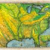
De L’Isle’s “Carte de la Louisiane” published in approximately 1731 would become the primary reference source for exploration of the Mississippi and Missouri river valleys and was used by other cartographers as late as 1797. Believed to be the oldest map consulted in the planning of the Lewis and Clark Expedition. All sizes are approximate. […]

Map Of Ulster Province, Ireland

09 Mar
Ireland ulster

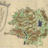
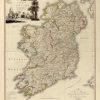
Did you know that the “-ster” suffix comes from the Irish word “Stair” meaning province. Ulster is one of the four traditional provinces of Ireland. This ancient Irish province comprises nine counties, three of which make up the Republic of Ireland (Cavan, Monaghan, Donegal), and the other are in Northern Ireland (Antrim, Down, Armagh, Derry, […]

Baptista Boazio’s Irlandiæ c. 1606

09 Mar
Baptista boazio

Some call it Irlandiæ accvrata descriptio and others say Irlandiæ accurata descriptio, but the map Baptista Boazio’s Irlandiæ c. 1606 = Irlandiæ accvrata descriptio is a magnificent work of art, science, and geographical knowledge combined. It was published in 1606 in Antwerp by Abraham Ortelius. This fine map of Ireland was produced by the reputed Italian cartographer Giovanni Baptista […]

Tuesday Travel Feature: Vero Beach, Orchid Island, And The Indian River, Florida

09 Mar
Untitled

This island can be described as an environmentally sensitive area (ESA), needing special protection; on the Atlantic portion of the Island are the fragile coastal dunes, wildlife breeding grounds and waters suitable for recreation and the management of fish and wildlife. The island has extensive mangrove areas, aquatic preserves, marine grass beds and shellfish waters. […]

Weekly Map Giveaway Winner!

27 Feb

Sign up for our weekly map give-away here! This week’s mystery winner is… dee.miller@ If your email address starts with “dee.miller” please email me at: [email protected] to claim your free map! The entire email address has been omitted for your privacy. The name on this page is changed weekly, and chosen with random.org. Thank you […]

Old Map Studies: Piri Reis, A Problem Among Antarctica Antique Maps!

31 Jan
piri-reis-antarcttica-antique-maps

Here’s one to throw around during your next cocktail party. The year was 1929, and the date was October 9th. German theologian Gustav Deissmann was rummaging through maps and books housed in the Topkapi Palace library, located in Istanbul, Turkey. While doing so, he discovered one of the most curious antique maps ever made. It […]