Sign up for our weekly map give-away here! This week’s mystery winner is… aaron.kohlheep@ If your email address starts with “aaron.kohlheep@ please email me at: [email protected] to claim your free map! The entire email address has been omitted for your privacy. The name on this page is changed weekly, and chosen with random.org. Thank you […]
Archive | Featured Article
RSS feed for this section3 Favorite map gifts for dads!

Someone once said, “Dads are most ordinary men turned by love into heroes, adventurers, storytellers, and singers of song.” The truth is that there is no other dad quite like yours, whether he’s old-fashioned, a jokester, a party animal, a DIY guru, a nature lover, or an eclectic individual. You can show your father, dad, […]
Travel Map Feature: Danube River, Passau to Budapest
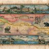
A lot can be said about the Danube. In fact, a lot has been said. Songs and poems have been written about life on and around its banks. It has served as a dividing line for countries and empires. Rome gave the Danube its significance by establishing it as a primary medieval trade route. Previously […]
Discovery Map Series: Old School Atlas Of The United States C.1847
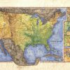
Woodbridge Map of the US 1847 This map of the United States was part of an atlas collection known as the Woodbridge Atlas. Produced in 1843, it was considered to be a modern atlas at the time. It’s purpose was to portray the attributes of various countries and regions as they relate to political orientation, […]
Travel Map Feature: Top Through Hikes of the Continental United States
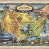
Top Through Hikes of the Continental United States Putting one foot in front of the other, trekking through the beauty and diversity of nature with land beneath your feet is one of the most liberating experiences. For those whose wanderlust needs to be satisfied, stretching across America are many awe-inspiring trails. Best of all, hikes […]
Discovery Map Series: Custom map of the Turquoise Trail, New Mexico
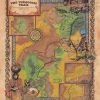
The Turquoise Trail, New Mexico Situated in central New Mexico, beginning in Tijeras and the Cibola National Forest and ending in the San Marcos/Lone Butte Area, the Turquoise Trail is a scenic and historic area which covers roughly 15,000 square miles, and connects Albuquerque and Santa Fe. The name is derived from the blue-green turquoise […]
Discovery Map Series: New Mexico Wagon Roads 1879
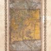
This map was originally taken from a Rand McNally Atlas c. 1879. It illustrates 19th Century New Mexican wagon roads, counties, military outposts, Native American reserves, volcanic fields, stage routes, and emigrant trails. All sizes are approximate.
Travel Map Feature: 258 Scuba Dives and Beaches of Cozumel
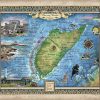
This map of the Scuba Dives of Cozumel is a wonderful tribute to the most beautiful diving in the world! Known to scuba divers everywhere, Cozumel is unquestionably the top destination. Show your support by giving this amazing map to the scuba diver in your life or commemorate this wonderful place in your own home! […]
Discovery Map Series: Dinosaur National Monument
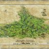
In a land where dinosaurs roamed centuries ago, remains the fantastic relics of their existence, along with a rich cultural history, preserved in the petroglyphs and pictographs left behind by Native American tribes that were inhabitants in the region of northwest Colorado and northeast Utah. This land of dinosaurs is where the Dinosaur National Monument […]
Ireland Map
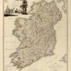
The mapping of Ireland during the 16th and 17th centuries reflected a period of political and religious shifts that shaped the territory. However, it also showed the cartographic advancements of the time, evident in increased accuracy and precise geographical information. This collection of Ireland maps feature the works of cartographers including, Map of Ulster Province, […]

Follow Us!