“Another Unsung Beauty by Lisa And Her Team”

“Another Unsung Beauty by Lisa And Her Team”

Regarded as one of the most significant maps of the 19th century, John Melish’s “Map of the United States of America: With the Contiguous British and Spanish Possessions, 1816,” depicts the United States extending from the Atlantic Coast to the Pacific Coast on the North American continent. It is said to be the first transcontinental […]

Called Jax by locals, Jacksonville is Florida’s most populous city, the largest city by landmass in the nation, and the fourth largest metropolitan area in the state. Jacksonville resides on the banks of the St. Johns River, about 25 miles south of the Georgia state line and 340 miles north of Miami. It is a […]
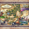
Colorado has the highest elevation of all the U.S. states, and it has some of the tallest mountain ranges in the U.S. as well. The state’s mountain scenery is arguably the most majestic and dramatic in the country. The State of Colorado was named after its great river the Colorado River, which Spanish explorers called […]
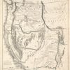
John C. Fremont was an American military officer, early explorer and mapmaker, who was instrumental in the mapping of the American West, and in effect, facilitated settlement in the region, in places like Oregon and California. On his 1842 scientific expedition, Fremont examined the Oregon Trail through the South Pass, detailing the rivers, fertility of […]
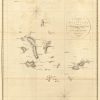
It was in the year 1793 that Captain James Colnett of the Royal Navy set sail in the merchant ship Rattler to do a survey of the Galapagos Islands to investigate the possibilities of sperm-whale fisheries in the region. Colnett’s Chart of the Galapagos is the first fairly accurate map of the archipelago. It was […]

Galapagos Islands The Galapagos Islands is an archipelago of roughly 19 islands and several smaller islets, over 500 miles off the Ecuadorian Coast in the Pacific Ocean. The islands became a World Heritage Site in 1978, protecting almost 35 million acres of land and sea. The Galapagos is recognized for its unique wildlife, especially for […]
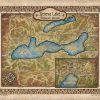
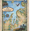
Welcome this vintage style map art for your lake house near Geneva Lake Wisconsin to give your home a regional feel and a reference to help guests familiarize themselves with the area. Great for Lake homes, new homeowner gifts, or traveler gifts, our lake map collection will help keep your special lake in your heart […]
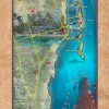
Named for the gold salvaged from shipwrecks off its coastline, the Gold Coast features some 60 miles of beautiful Atlantic shoreline, which extends from the unspoiled sands of Palm Beach to the legendary strip of beaches in Fort Lauderdale. Situated along Florida’s southeastern coast, miles once sprawling with grassland and vacant lots, Gold Coast has […]
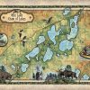
There’s more to a lake than it simply being a body of water. Many lakes have helped to shape the vibrant history and culture of certain regions. Lakes provides environmental benefits, influence quality of life, strengthen economies through tourism, provide amazing opportunities for recreation and cottage/residential living, and serve as a source of drinking water […]
Follow Us!