Sign up for our weekly map give-away here! This week’s mystery winner is… lscorza@ If your email address starts with “lscorza” please email me at: [email protected] to claim your free map! The entire email address has been omitted for your privacy. The name on this page is changed weekly, and chosen with random.org. Thank you […]
Archive | mappa monday!
RSS feed for this sectionTravel Tuesday Map Series: South Bay And Silicon Valley, California
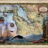
Perhaps one of the most well-known landmarks in architectural history, the Golden Gate Bridge stands in beautiful San Francisco, Califonia. This vintage map featuring Orcas, the Golden Gate Bridge and elements of the stunning Silicon […]
Discovery Map Series: Hiking Trail Of Yellowstone National Park
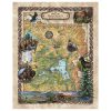
Yellowstone National Park Hiking Trails Largely situated in Wyoming and extending into Idaho and Montana, the Yellowstone National Park is a natural, scientific, and scenic unspoiled beauty. In 1872, it became the first national park in the United States covering an area of more than 3, 400 square miles. Yellowstone National Park was home to […]
Travel Tuesday Map Series: Beaufort Map, North Carolina
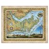
Invite this gorgeous North Carolina map into your home today. Carefully researched and exquisitely colorized with our distinctive and inviting colors, this vintage map of the breathtaking Crystal Coast in North Carolina is a great gift for a traveler, a housewarming gift, or just for you in your regional home. Please read more about the […]
Discovery Map Series: Bob Marshall Spotted Bear Montana Historic Map Art Print
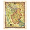
Named in honor of the early wilderness advocate, the Bob Marshall Wilderness complex includes three wilderness areas and is surrounded by protected lands totaling more than 2.54 million acres. This wild and roadless wilderness train is only accessible in the company of mountain men and those who seek to learn quickly the ways of the […]
Tuesday Travel Map Series: Crater Lake National Park Oregon
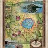
Located in the Cascade Mountains of southern Oregon, Crater Lake National Park was established on May 22, 1902. This natural wonder emerged from a cataclysmic volcanic eruption. The unique landscape covers some 180,000 acres of protected lush, vibrant forests, an abundance of wildlife, and Crater Lake aka ‘lake majesty’, the beautifully blue, awe-inspiring crown jewel […]
Travel Tuesday Map Feature: Savannah and Tybee Island
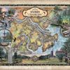
Use discount code SAV to get 50% off! Affectionately dubbed the “The Hostess City of the South,” Savannah was established in 1733 and is known to be the oldest city in the State of Georgia, and America’s first planned city, which still maintain 22 of its 24 original squares today. The name Savannah is believed to […]
Discovery Map Series: Columbia River, Headwaters to the Pacific Ocean
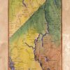
Columbia River Whether it is called the River Oregon, Big River, or River of the West, the Columbia River is the largest river in North America that drains into the Pacific Ocean. The Columbia River drains a basin that is approximately 260,000 square miles, from its headwaters in the Rocky Mountains of British Columbia, Canada […]
Travel Map Feature: 208 Custom map of Hawaii Waterfalls, Beaches, and Natural Lands
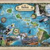
Out in the middle of the Pacific Ocean lies Hawaii, home to one of the world’s most active volcanoes and the tallest sea mountain in the world. This chain of islands is roughly 2000 miles (3200 kilometers) from the coast of the Continental United States. Hawaii is made up of eight major islands and more than […]
Discovery map Series: California’s First Appearance on a Map!
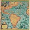
Join us every Sunday night for our Discovery Map Series! For a century, Americae Sive Quartae Orbis Partis Nova Et Exactissima Descriptio (A New and Most Exact Description of America or The Fourth Part of the World) remained the largest map of the Americas. The number of copies that were printed for circulation is unknown, […]

Follow Us!