Myths and Legends of the Ancient Mississippi River Valley as Told Through Maps The Mississippi River Valley, running from the present-day U.S. states of Illinois, Missouri, Arkansas, Louisiana and Mississippi, has been riddled with myths and legends, regarding the settlement, cultural influence and establishment of North American pre-Columbian civilization and what we now accept as […]
Archive | Uncategorized
RSS feed for this sectionEducational Map Series: The Most Important Regional Map of America in the 17th Century

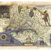
Believed to have been published in Amsterdam in 1642, Nova Virginiae Tabvla is the work of Flemish cartographer and engraver Hendrik Hondius. Hondius was apprenticed to Godfried van Ghelder in Brussels, studied drawing with the engraver Jan Wierix of Antwerp, and he also studied engraving along the way, to which he dedicated himself as a […]
RETAILER FEATURE: Well-Organized Retail Displays!
-Tips for effective map art wall displays- We know you’re the experts in merchandising but here are some things we’ve learned from our shops around the country and our art shows. When your customers search through your store looking to fall in love with a new piece of artwork, there are plenty of things you […]
Old Map Studies: Maps in the Golden Age and Explorations of Southern Lands!

After the Age of Discovery enough information about geographical features from surveys had been collected that map makers were able to create maps of much higher accuracy. During the late 15th Century the Italians largely dominated map making. By the 16th and 17th Centuries, the Netherlands had become the center of mapmaking. In the Netherlands […]
Educational map Series: Burritt’s Geography of the Heavens
Enjoy our educational map series every Sunday night! Eighteenth and 19th century technologies transformed the way the night sky was observed and led to the discovery of celestial wonders, from stars, galaxies, meteors, moons, planets and comets, to nebulae. The result was, in part, the creation of celestial maps that showed an exponential number of […]
Book Feature: Railroad Stories Volume 1 Ebook sample!
An Anthology of True Adventures, Humorous Tales, and High Melodrama Written by Those Who Lived the Era! Edited, with Introductions by Michael Gillespie. Full Index, Glossary, and dozens of Historic Steam Rail Photographs. Download your instant sample today! Get your copy rigth here: https://great-river-arts.myshopify.com/products/limited-time-offer-pdf-download-of-old-time-railroad-stories-by-michael-gillespie
Educational Map Series: More to discover from an Ortelius Classic

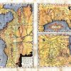
Enjoy our educational map series every Sunday night! According to Philip D. Burden, in his book entitled, The Mapping of North America: 1671-1700, Peruuiae avriferae regions typus, “is one of the very few maps printed in the sixteenth century that was based upon original Spanish sources…. The first regional map of the south-eastern portion of […]
Mother’s and Father’s Day Easy shopping options!

Hand painted originals available now! Usual wait period is 1 month! Top selling Pacific Northwest and Rocky Mountain maps Favorite Mississippi River Collection Discover! America’s Great River Road: Heritage and Natural History Guidebooks East coast Collection Eastern Florida Western Florida Custom Framing Services Old Time Railroad Stories in three volumes Steamboating on America’s Rivers!
Retailer feature: Framing print samples for Maximum Sales

Framing Suggestions to Boost Map Art Sales Keep in mind that our historical maps do best when sold as art pieces rather than academic material. To maximize your profit, you should focus on the artistic qualities of the maps. They will sell much better if the buyers are focused on the decorative potential of the […]
Educational Map Series: The Brave Map Depicting the new Continent

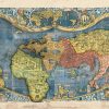
Did you know that before this map Europeans believed that the world was divided into only three parts? They knew a world divided into Europe, Asia, and Africa. This ambitious project served to document and update new geographic knowledge derived from the discoveries of explorers in the late 15th and early 16th centuries, and in […]

Follow Us!