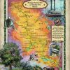
Lake Pepin From Voyageur Playground to French Royalty Lake Pepin, otherwise known as, ”the Lake of Tears,” was formed by the delta of the Chippewa River, which flows into the Mississippi, at the southwestern edge of Wisconsin. The lake swells into a widening along the Mississippi River (See figure 1). It’s status as a naturally […]
Archive | Uncategorized
RSS feed for this sectionEducational Map Series: Say goodbye to the old age and hello to a new era!

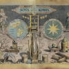
Map of the Western Hemisphere Say goodbye to the old age and hello to a new era… Jan van der Straet in his title plate engraving from his print series entitled Nova Reperta (New Inventions of Modern Times), designed around the 1850s, echos those words through his striking depiction of an evolving world. Map of […]
Book Feature: Mississippi River Book and Map Sampler!

BUNDLE AND SAVE More than $25! Limited time offer! A $110 Value! Discover! America’s Great River Road by Pat Middleton The classic best-selling Guide to Heritage and Natural History along the Mississippi River From St. Paul to the Delta in four volumes… “Discover! America’s Great River Road is an indispensable guide for those who enjoy cruising […]
Custom Map Feature: Get your Island on the map!

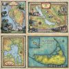
Usually our Minimum order for custom maps is $850! This month we are running a special on our island maps! If you live on an island or love one you can order your own 24×36″ print for $175 even if we don’t have it in stock. In fact….we will make it with you in mind! […]
Retailer Feature: Mastering the Art of Lighting for Maximum Print Sales!

There are many ways you can increase sales of our hand-painted historical maps without investing a lot of time or money. Utilizing proper lighting is one of the best ways you can attract the attention of your customers. Lighting creates a pleasant atmosphere, and allows your customers to fully appreciate the intricate details of our […]
Old Map Studies: The Controversy of the Round Earth Theory!
The Controversy of the World Not Being Flat The idea that all people believed the Earth was flat until the Age of Discovery and Christopher Columbus sailing West is a myth. While some people did believe that the Earth was flat then and even still do today, among educated circles dating as far back as […]
Help your customers design their own maps!

Help Your Customers Design their own Maps! Perfect for Family estates, ranches, resorts, vacations and milestones! Why work with us: 1. Effortless fulfillment services- you just close the sale and charge what you want! 2. Proven Customer service and sample work. 3. Satisfied customers include Wisconsin Public Radio, Farm Bureau Insurance, and Turner Enterprises. Payment: Our list price is $3,500 […]
Book Feature: 5-Book Railroad Bundle by Michael Gillespie

BUNDLE AND SAVE More than $25! Limited time offer! Michael Gillespie’s 5-book River and Rail Steam Bundle! A $110 Gift Pack of our Most Popular Paperback Transportation books for Just $90! A perfect match for Lisa Middleton’s historic maps from the turn of the 19th and 20th centuries! Paperback series of Mike Gillespie’s most beloved […]
Educational Map Series: Manhattan 1638- the first true map of Manhattan Island!

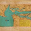
This beautiful manuscript map is the work of Dutch cartographer and watercolorist Joan Vinckeboons, published in 1639. Vinckeboons came from a family of artists and started out drawing for his father. Around 1640, he got into map-making and is known for his beautiful watercolor manuscript maps of the East and West Indies. His stunning works […]
Retailer Feature: The importance of placement and rotation of product for maximum sales
At Great River Arts, we often tell our customers to focus on placement. Where you hang a piece of artwork in your house can have a great effect on its mood and impact. In some cases, proper placement can even determine whether a painting gets constant complements or goes completely unnoticed. When displaying our historical […]

Follow Us!