Archive | mappa monday!

RSS feed for this section

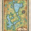
Tuesday Map Feature: Spirit Lake And Lake Okoboji, Iowa Lake Art- The Great Lakes Of Iowa

27 Oct
spirit lake

  There’s more to a lake than it simply being a body of water. Many lakes have helped to shape the vibrant history and culture of certain regions. Lakes provides environmental benefits, influence quality of life, strengthen economies through tourism, provide amazing opportunities for recreation and cottage/residential living, and serve as a source of drinking […]

Travel Map Feature: 283-Lake of the Ozarks, Missouri

20 Oct

As the largest man-made lake in the Midwestern United States, Lake of the Ozarks extends across the Missouri counties of Benton, Camden, Morgan and Miller. It has a surface area of 54,000 acres and 1,150 miles of shoreline, with the main channel of the Osage Arm stretching for 92 miles and a total drainage area over […]

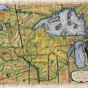
Discovery Map Series: 027 Carver Map of one Early route to the Northwest passage 1781

18 Oct
Carver_Map_4x6_2

Plan of Captain Carvers Travels 1781 Detailing the travel routes that Capt. Jonathan Carver made to the interior parts of North America, this 1781 map by the same name is quite detailed. Colorization is used to detail the boundaries of theof the area. These include mostly Native Americans as well as a few other types […]

Discovery Map Series: 259 Custom map of Lake Minnetonka, Minnesota

30 Aug
2

Nestled within western Hennepin County and Carver County, Minnesota, Lake Minnetonka holds unique meaning for different people. The retreating Wisconsin Glacier of the last Ice Age that produced melted blocks of ice, gave life and form to this island lake. It was Alexander Ramsey, Minnesota’s territorial governor in 1852, who gave Lake Minnetonka its name. […]

Travel Tuesday Map Feature: The Sites Of Death Valley National Park, California

18 Aug
death_valley

Straddling the California-Nevada border, Death Valley National Park occupies a desert valley area between the arid Great Basin and Mojave deserts. It is the hottest and driest place in America, and the lowest of all the national parks in the lower 48 states. Covering 3.3 million acres, this park features salt-flats, mysterious rocks, sand dunes, […]

Discovery Map Series: Earliest Chart Of The Galapagos A. Arrowsmith, 1798

16 Aug

It was in the year 1793 that Captain James Colnett of the Royal Navy set sail in the merchant ship Rattler to do a survey of the Galapagos Islands to investigate the possibilities of sperm-whale fisheries in the region. Colnett’s Chart of the Galapagos is the first fairly accurate map of the archipelago. It was […]

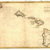
Discovery Map Series: Historic Hawaii Collection

26 Jul
Hawaii_4x6

Hawaii has a rich history and culture shaped by an enduring heritage, struggle and its natural environment. Cartography has helped to convey important aspects of the Hawaiian story, particularly as it relates to politics. Before the Kingdom of Hawaii became a territory in 1900, it had enjoyed sovereignty through monarchical rule for some 100 years. […]

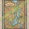
Travel Map Feature: Lake Keowee, South Carolina

14 Jul
huge_map_old_map_retro_lake_keowee

The Lake Keowee region supports a diverse flora and fauna. Aquatic plants include alligatorweed, coon’s tail, waterweed, while common species of trees comprises bald cypress, water tupelo, red maple, sweetgum, water ash and water oak. An abundance of fish can be found in Lake Keowee, including carp, spotted sucker, redbreast sunfish, silver redhorse, spottail shiner, […]

Discovery Map Series: Na Mokupuni O Hawaii Nei Historical Map Of Hawaii 1837

12 Jul
Na_mokupuni_O_Hawaii_Nei_Historical_map_of_Hawaii_1837

The map “Na mokupuni O Hawaii Nei,” published in 1837 by Kulanui Lahainaluna, Maui is the first separate map of the Hawaiian Islands published in Hawaii and the first Hawaiian-language map of the islands. It is the work of Simona P. Kalama, who engraved and drew the map. Kalama was a top student engraver at […]