Archive | mappa monday!

RSS feed for this section

Discovery Map Series: Piri Reis Map – The Mystery of Antarctican Exploration

14 Aug
June2Edu

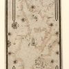
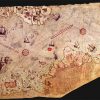
Piri Reis Map, 1513, is considered to be a world map, but portions of the map is missing, with only about one third of the map surviving today. The significance of the map is relevant to the history of the exploration of the New World or the Western Hemisphere. It is believed that the map […]

Discovery Map Series: Portolan Chart Of The Mediterranean And Connecting Seas 1550

07 Aug
portolean_chart_of_mediterreanean

It was in the year 1793 that Captain James Colnett of the Royal Navy set sail in the merchant ship Rattler to do a survey of the Galapagos Islands to investigate the possibilities of sperm-whale fisheries in the region. Colnett’s Chart of the Galapagos is the first fairly accurate map of the archipelago. It was […]

Travel Map Feature: Lake Norman, North Carolina

02 Aug
3.2 Travel Map

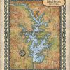
The Lake Norman region supports a diverse flora and fauna. Aquatic plants include alligatorweed, coon’s tail, waterweed, while common species of trees comprises bald cypress, water tupelo, red maple, sweetgum, water ash and water oak. An abundance of fish can be found in Lake Norman, including carp, spotted sucker, redbreast sunfish, silver redhorse, spottail shiner, […]

Discovery Map Series: Map Of The Hawaiian Islands 1876

31 Jul
hawaii_1876

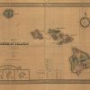
Under the direction of William D. Anderson, Surveyor General of the Hawaiian Government Survey, Map of the Hawaiian Islands, 1876 was created and published for the celebration of the 100th anniversary of American independence by J. L. Smith Co. More specifically, it was for the Hawaiian Exhibit at the International Exhibition of Arts, Manufactures and Products […]

Discovery Map Series :1867 County Map of New York State

24 Jul
New_York

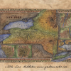
This county map of the state of New York by Samuel Augustus Mitchell is detailed out to the county level. Special attention is given to geographical features, towns, cities, and proposed railroads. The railroad was a major form of transportation during the time, and as such, new depots and railway lines were always in the […]

Discovery Map Series: 001 1737 Heirs Map of British North American Territories

17 Jul
2. Education

This map is a derivative work by Heir. It was taken from a British territories map produced by Herman Moll. Derivative works were common among cartographers. It was considered a sort of honor to have your work serve as the basis for future productions. It spoke to the accuracy and expert craftsmanship you had produced. […]

Travel Tuesday Map Series: 010 A new map of Lake Pepin 2014 By Lisa Middleton

12 Jul

  This beautiful 2014 historical and geographical map of Lake Pepin on the Mississippi River was created by Midwestern Map Artist, Lisa R. Middleton from current U.S. Army Corps of Engineer Charts. It pinpoints numerous islands and landmarks visible to those cruising on land or on water. The Sea Wing, traveling between Lake City and […]

Discovery Map Series: 101 Oregon, Upper California and New Mexico 1849

10 Jul
1.0

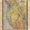
This map is an example of Mitchell’s 1849 map of the West, at the time of the discovery of gold in California and immediate after the completion of Fremont’s final expedition. This is one of the best maps of the West of the era, reflecting the contemporary knowledge of the west. The California Gold Regions […]